
Sugar Hill Neighbors by Source
A block search starts with geography. Gwinnett GIS shows parcel lines and adjoining land. The assessor adds the tax owner, mailing address, situs address, and parcel details. A lawfully released voter file may show registered presence by residence address, but Georgia My Voter Page verifies one person with identity facts and cannot list a street. Sugar Hill's community inventory names subdivisions and shared facilities without publishing private member lists.
| Source | What It Shows About a Block | Access |
|---|---|---|
| Gwinnett GIS Data Browser | Parcel boundaries, address labels, jurisdiction and nearby tracts | Free public viewer |
| Gwinnett assessor | Tax owner, mailing and situs relationship for each parcel | Free property search |
| Lawfully released voter data | Registered presence by residence field if released | Custodian request and use limits |
| Sugar Hill parks plan | Community name, anchor street, homes and shared facilities | Public plan, no member roster |
| Historic and civic sources | Cemetery, congregation and neighborhood context | Public pages or archive research |
A parcel owner may live elsewhere. A renter or other household member may leave no public parcel trace. Registration can lag a move, and a community roster may be private even when the association name is public. The strongest result is therefore a map of official relationships, not a claim about every person nearby.
Buffer Sugar Hill Neighbor Parcels
The Gwinnett GIS Data Browser supports a precise block method. Search the subject address or parcel identification number, zoom to the block, and turn on parcel, boundary, and address-label layers. Point Identify returns one selected polygon. Area, Line, and Buffer Identify can collect nearby features across a chosen shape or distance.
Results can be refined, grouped, buffered, and exported. The measure control reports line or area units. A share tool saves the visible layers and map extent in a URL or QR code. That makes a parcel review easy to repeat. Still, an adjacent polygon means adjoining land. It does not prove a social relationship or identify each person at the property.
Note: County GIS is an aid for block research, not a survey, title opinion, or complete household directory.
Sugar Hill Owners Are Not Occupants
Three address fields can point in different directions. The situs address locates the parcel. The mailing address tells where the assessor sends tax correspondence. A legal description identifies the land through district, land lot, parcel, subdivision, lot, or plat language. When an owner's mailing address differs from the situs address, the roll cannot explain why.
- Parcel
- A mapped tract of land with its own county identifier.
- Situs address
- The physical address assigned to the parcel.
- Mailing address
- The destination for tax notices, which may be elsewhere.
- Buffer
- A selected zone around a map feature used to find nearby features.
The owner may be a person, trust, estate, company, or public body. Some owners occupy their parcels; others do not. Renters and household members are not independently disclosed by the parcel roll. This is the key limit in any lookup of Sugar Hill neighbors.
Sugar Hill's Community Scale
Sugar Hill's 2024 parks plan inventories 28 communities with 3,564 homes. It counts 19 clubhouses, 25 pools, 39 tennis areas, one trail, 14 play structures, and five pavilions. Those figures describe neighborhood form and shared facilities, not private people. The plan supplies verified community names and anchor streets without exposing members.
| Community | Anchor street | Homes |
|---|---|---|
| Lakefield Forest | Allison Drive | 131 |
| Wild Timber | Wild Timber Road | 324 |
| Emerald Lake | Emerald Parkway | 220 |
| Primrose Creek | Primrose Park Drive | 255 |
| Riverside Walk | Riverside Way | 230 |
| Preserve at Addison Woods | Addison Woods Drive | 62 |
Other verified examples include Twin Creek, Oaks at Lanier, Arbor Clos, and Hadley Township. No city umbrella association directory or public HOA member roster was found. Shared amenities do not turn a private membership list into a public directory of neighbors.
Sugar Hill Civic Neighbor Layers
The Sugar Hill Historic Preservation Society maintains a city-hosted veterans resource for people buried in Sugar Hill Historic Cemetery. The cemetery began with Sugar Hill Baptist Church and cemetery organization in 1886. That focused historical index can link a name with military, newspaper, census, and death evidence.
Historic Preservation Society
Supports local history and digital archive work.
Sugar Hill History Museum
Curates community stories at 5010 West Broad Street.
Gwinnett Public Library
Offers obituary and article research across county newspapers.
The library reader can print, email, or save historical newspaper images. A dated notice may document a move, sale, family event, or former street reference, but it should be paired with parcel and deed evidence for that date. Congregation names in the city plan do not make private member rosters public.
Sugar Hill Voters Are Not Browseable
Georgia My Voter Page requires first initial, last name, county, and date of birth. A match can return registration status, polling place, precinct and district assignments, sample ballot, and election information. It verifies one voter and cannot reveal everyone on a block. Georgia does not register voters by political party, and participation history never reveals ballot choices.
A request for an existing voter dataset should state the geographic scope and date and must follow statutory use restrictions. Protected addresses, complete identifying numbers, phone numbers, and email addresses are not assumed available. Registration may lag a move, so even a valid match does not prove current physical occupancy. The exact current voter-file fee and delivery format were not verified, so no fixed price or download promise is made.
Compare Sugar Hill Neighbor Sources
Official records and commercial neighbor tools serve different roles. County and state sources define their fields and legal custodian. Commercial products compile data from many places, may be stale, and can merge people with similar names. They should never replace the parcel map, source index, or a clerk-issued copy.
| Source type | Best use | Main limit |
|---|---|---|
| GIS and assessor | Map parcels and tax owners | Does not list each occupant |
| Voter custodian | Lawful registration facts | Protected fields and use limits |
| Community plan | Name subdivisions and shared assets | No household roster |
| Commercial compilation | Lead for later verification | Unclear age and identity matches |
In 2025, Gwinnett moved some sales, building, owner, and property detail out of the GIS information panel and directed users to the assessor for current detail. The map remains the right tool for shape and nearby parcels. The assessor is the better stop for the current tax record.
Map a Sugar Hill Block
The block workflow stays close to one starting parcel. It maps the adjoining tracts, records the tax-owner names, and preserves the limits of each result. A full named-street chain is a separate task.
- Search the address or PIN in the Gwinnett GIS Data Browser.
- Turn on parcels, boundary, and address labels, then identify adjoining polygons.
- Open the assessor record and compare situs, mailing, subdivision, and tax-district fields.
- Save the visible layer set and extent so the same block can be checked again.
The result flows as: address to parcel, parcel to adjacent polygons, polygons to assessor records, then owner names to deeds when needed. For every parcel along the named road, switch to the Sugar Hill Street Directory and its street-by-street record chain.
Sugar Hill Geography Changes Custody
Postal Sugar Hill and the legal city boundary are not identical. City limits intermix with unincorporated pockets, while the municipal gas system serves more than 38,000 people beyond the 25,076 residents counted inside the city in 2020. A neighborhood identity may therefore cross the line that decides which office keeps a permit or code record.
Use GIS jurisdiction and municipal-boundary layers before sending a request. City permit and municipal records go through Sugar Hill. County parcel, deed, most court, probate, election, and vital sources remain with Gwinnett offices. A postal city label alone is not proof that the parcel sits inside Sugar Hill.
Note: Verify the parcel's jurisdiction before assuming a city department holds the record for a nearby address.
Read Public Safety Results Carefully
The manifest contains one successful neighbor-page capture from the Gwinnett Sheriff Jail View. That service reports current booking and release context, identifiers, age at booking, bond or holds, and charge rows. A booking is not a conviction, and a custody result does not establish where the person lives now.
View the official Gwinnett Sheriff inmate-search source.
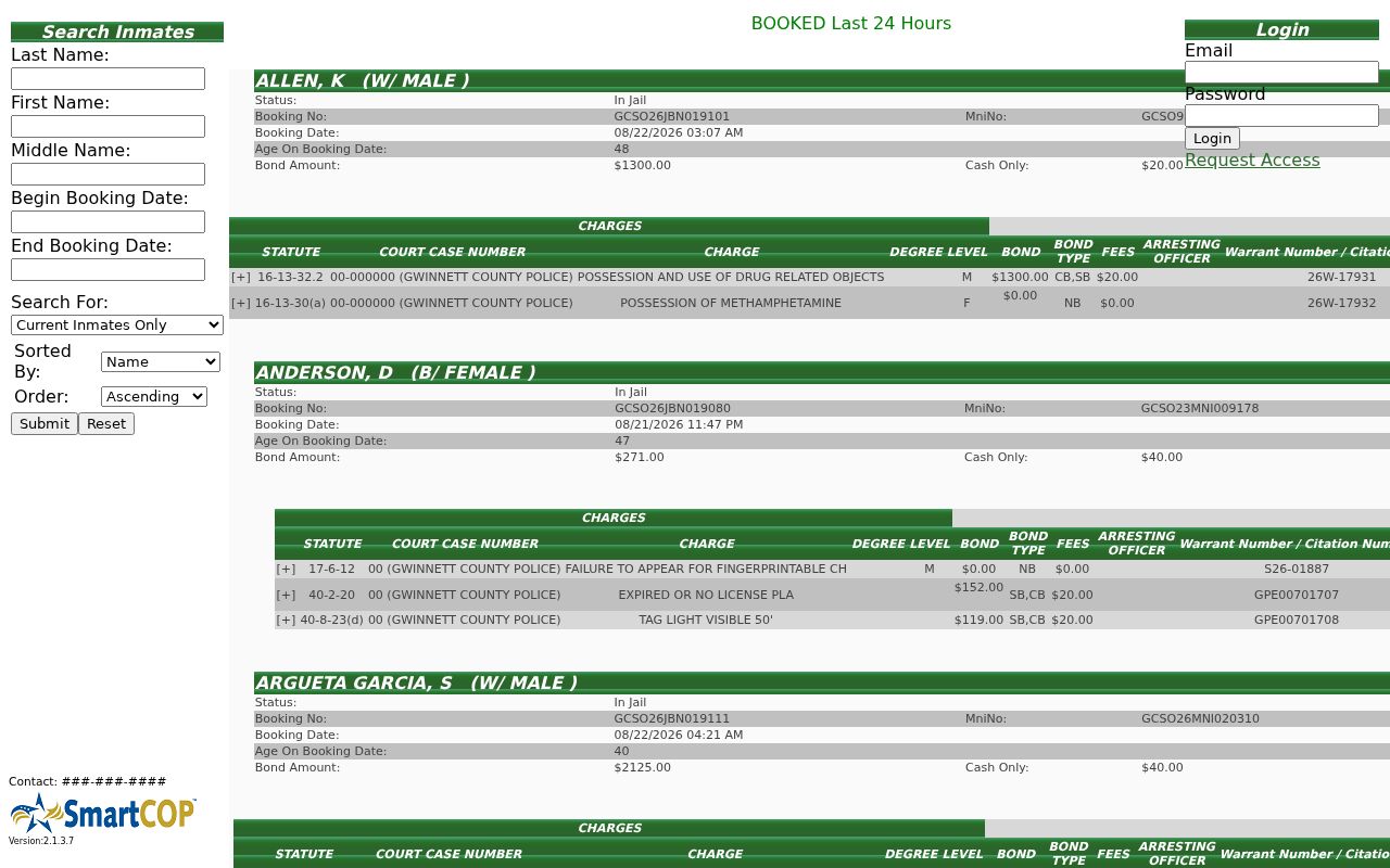
Use this source for its stated public-safety purpose and verify the case with the responsible court. Never use a similar name, an old booking, or an estimated release field to label a person on a block.
Protect Sugar Hill Neighbors' Privacy
Private HOA rosters, congregation membership, renters and unrecorded household members, utility or delivery accounts, sealed files, and protected voter locations stay outside a public neighbor lookup. Georgia Safe at Home, effective July 1, 2026, provides qualifying survivors a substitute address, secure mail forwarding, and protected voter registration. Public records must not be combined to reconstruct the actual location.
Georgia law restricts commercial use of elector lists. It also prohibits stalking and harassing communications. An address appearing in a public file is not consent to watch, contact, or intimidate the person tied to it. Stop when a record is private, sealed, or protected.
Lawful use. Research Sugar Hill neighbors only for lawful personal reasons. Do not use records to stalk, harass, threaten, surveil, or harm anyone.